
A copper porphyry target 5,000 feet from the Bayhorse Silver Mine, in Idaho.
In January 2024, as a result of the recent discovery by Hercules Silver 45 km NE of the Bayhorse Silver Mine, of a “copper porphyry” at their Cuddy Mountain Project, we conducted a VTEM survey of both the Bayhorse Mine and the recently acquired 4 square miles of claims 1/2 mile away, across the Brownlee Reservoir on the Snake River, that separates the State of Idaho from Oregon.
The Bayhorse terrain is the same as that which appears at Cuddy Mountain, and the VTEM response indicated a large (100 m to 550 m) deep target of low resistivity, that we would expect for a potential “Porphyry” target, or a cluster of “Porphyry” targets.
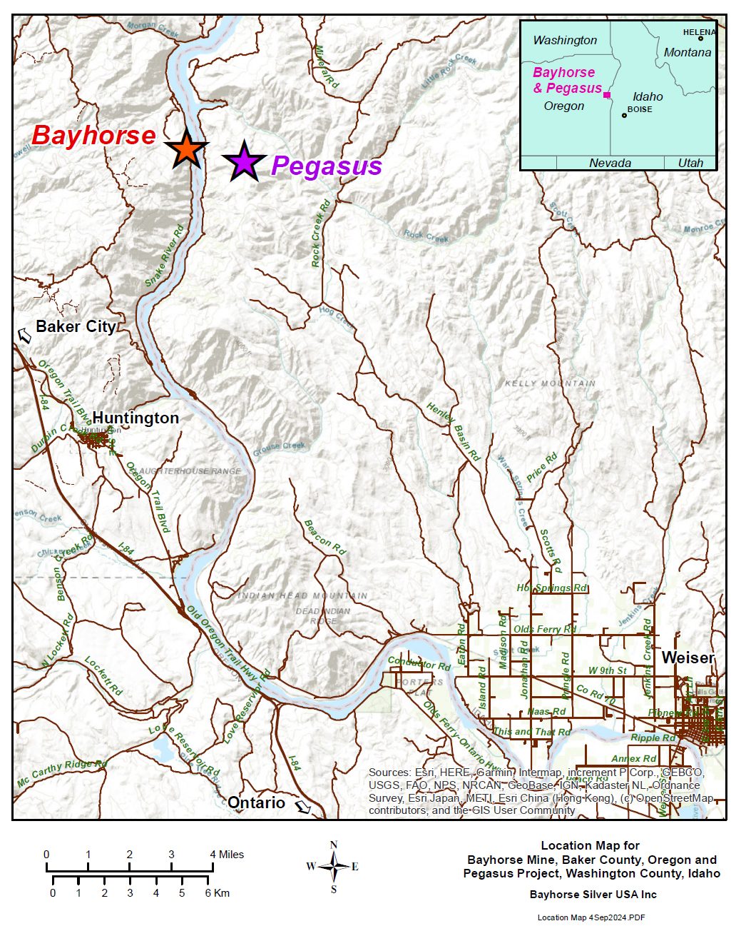
The Pegasus geology sampling images from the recent geological mapping (BHS2024-15) are presented below, and VTEM data, (BHS2024-05) that are currently only provided as PDF files, are linked below.
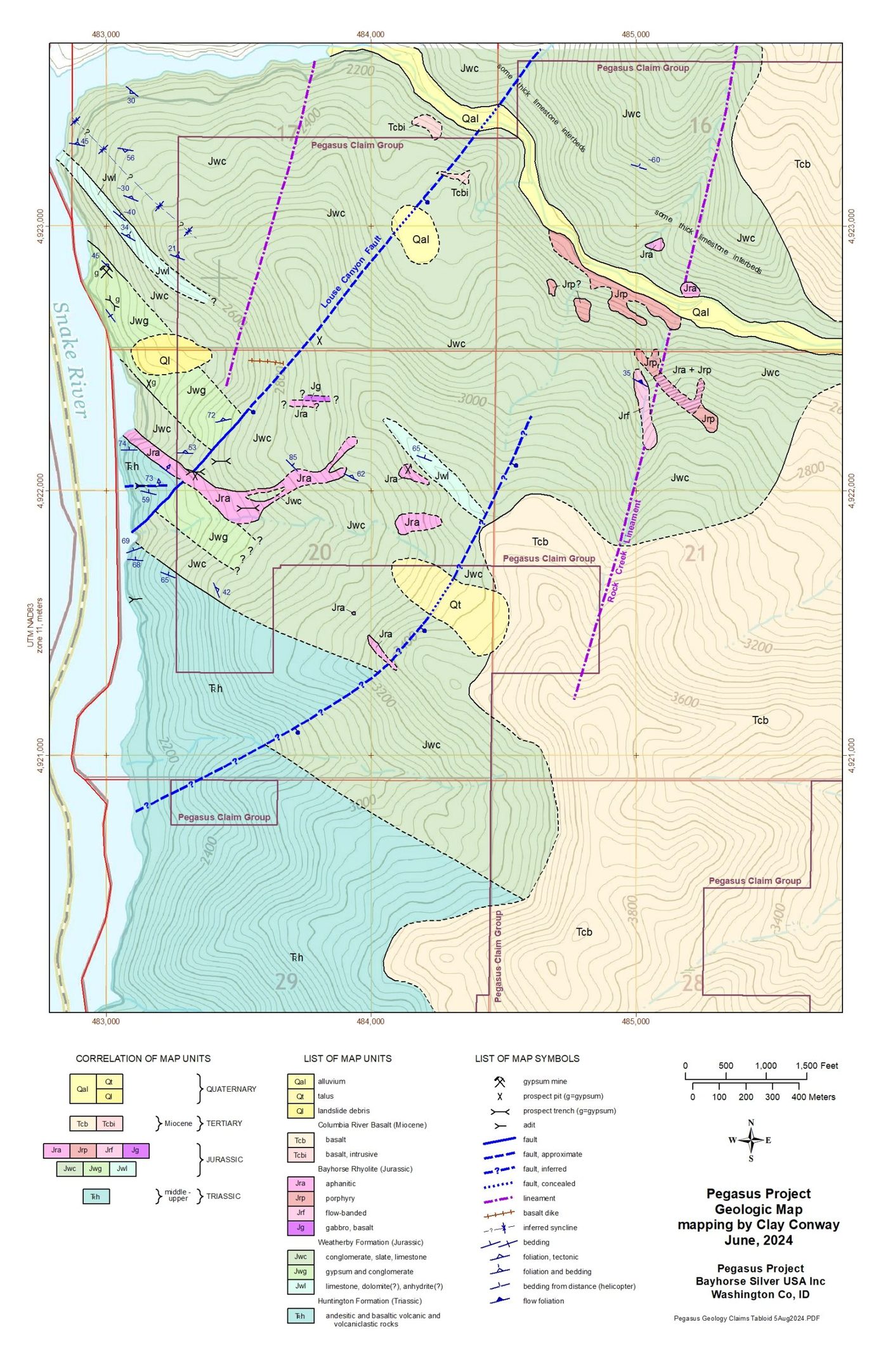
Pegasus geology with claims outlined
The linked PDF file shows the Pegasus low resistivity target, that is a blind target partially overlain by Columbia River Basalt, profiled every 25 meters, starting at 100 meters below surface, and extending down to a minimum 550 meters below surface.
Deep drilling and downhole geophysics are the best tools to determine just what the low-resistivity zone mineralization and structure is, but further surface or airborne geophysics are also warranted, both to the east and south of the Pegasus low-resistivity signature that has a west-east horizontal extent of +/- 1500 ft, to show its full extent east-west and north-south.
The Bayhorse low resistivity signature, that extends north nearly 1.5 Km from the east end of the Bayhorse Silver Mine, has been identified as a possible Pluton that fed hot mineralized fluids up into, and to the east and west of the Bayhorse.
The edge of another low-resistivity zone shows commencing approximately 750 ft west of the western extent of the Bayhorse underground workings. Confirmation drilling the south end can be conducted by deep drilling from the Bayhorse Mine underground workings.
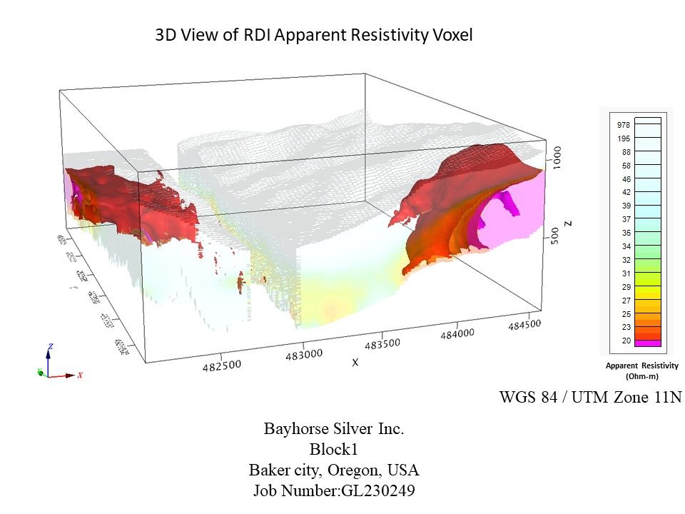
VTEM resistivity voxel model
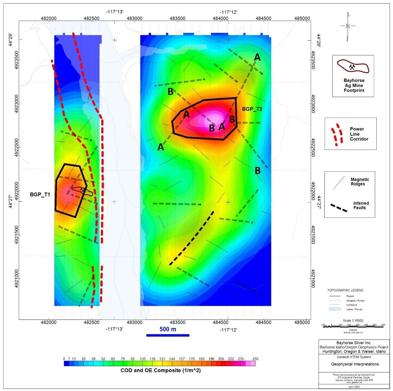
Low magnetic zone identification
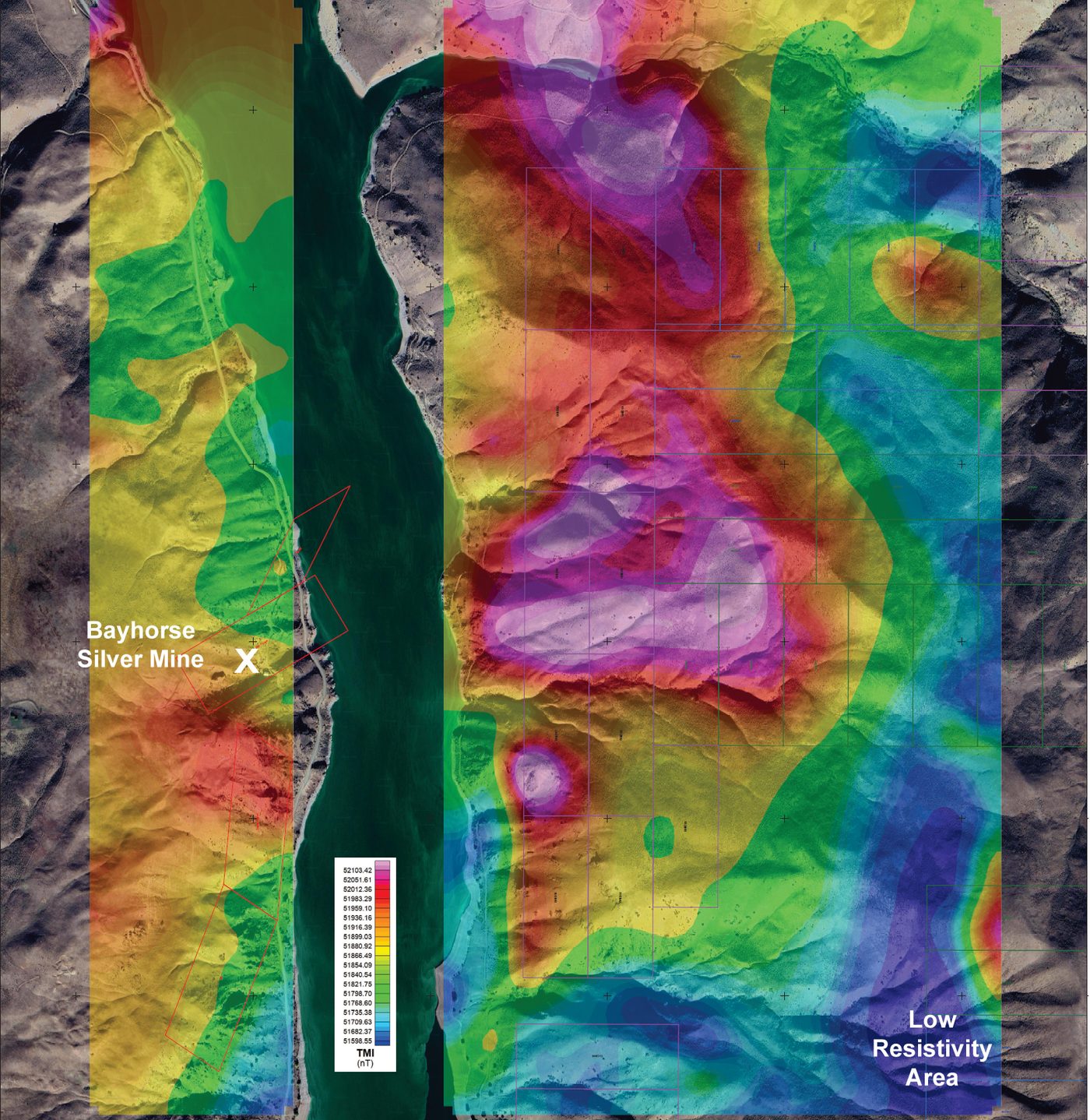
Annotated VTEM total magnetic intensity, March 2024
A drill plan has been completed and drill approvals have been received for a minimum of five diamond drill holes of up to 600 m (2,000 ft).