
A past producing silver mine in Baker County, Oregon, 100% controlled by Bayhorse Silver.
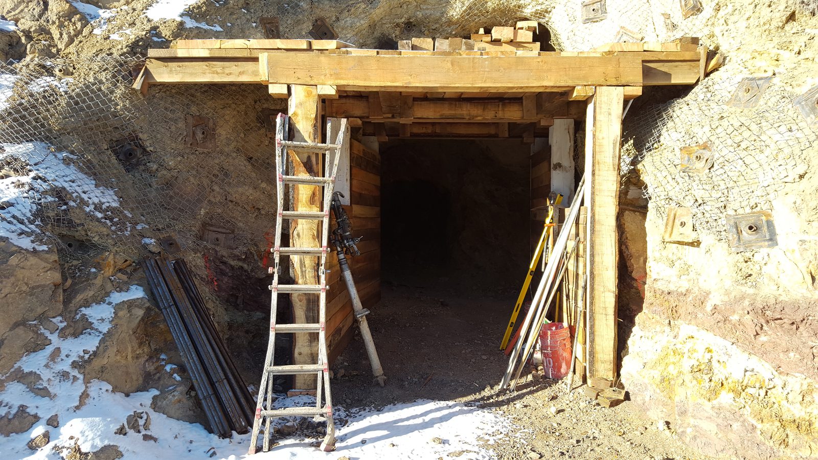
The Bayhorse Property has been historically identified as the location of the largest silver deposit found in the state of Oregon. Mining has been conducted intermittently at Bayhorse since the early 1920s and the mine last closed after the price of silver dropped to under US$6/oz in late 1984. The Bayhorse Silver Mine has two existing accessible rehabilitated adits where mineralized material is being extracted.
Bayhorse Silver is in the process of an Operating Permit application to resume mining at its Bayhorse Silver Mine, Baker County, Oregon, USA
The main adit extends over 1,400 feet westward into the hill and the lower extending 600 feet into the hill. The Intermediate Level workings were accessed by an adit installed in 1984. Until then that level was reached only by raises from the lower level and winzes from the upper level. Three areas have been stoped in the ground between the upper and intermediate level.
The Bayhorse Silver Mine is now in an active state, where the mineralized material extracted from the mine can be upgraded using a state of the art “Steinert” Ore-Sorter, before further processing at its Flotation Facility, where a silver concentrate can be produced.
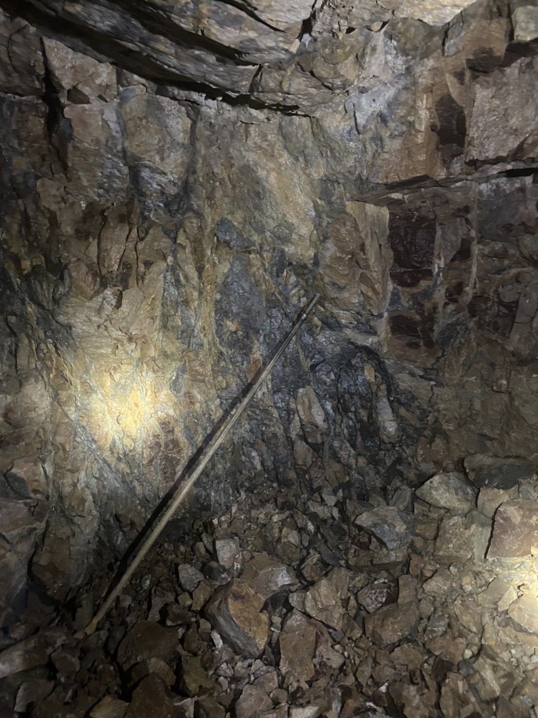
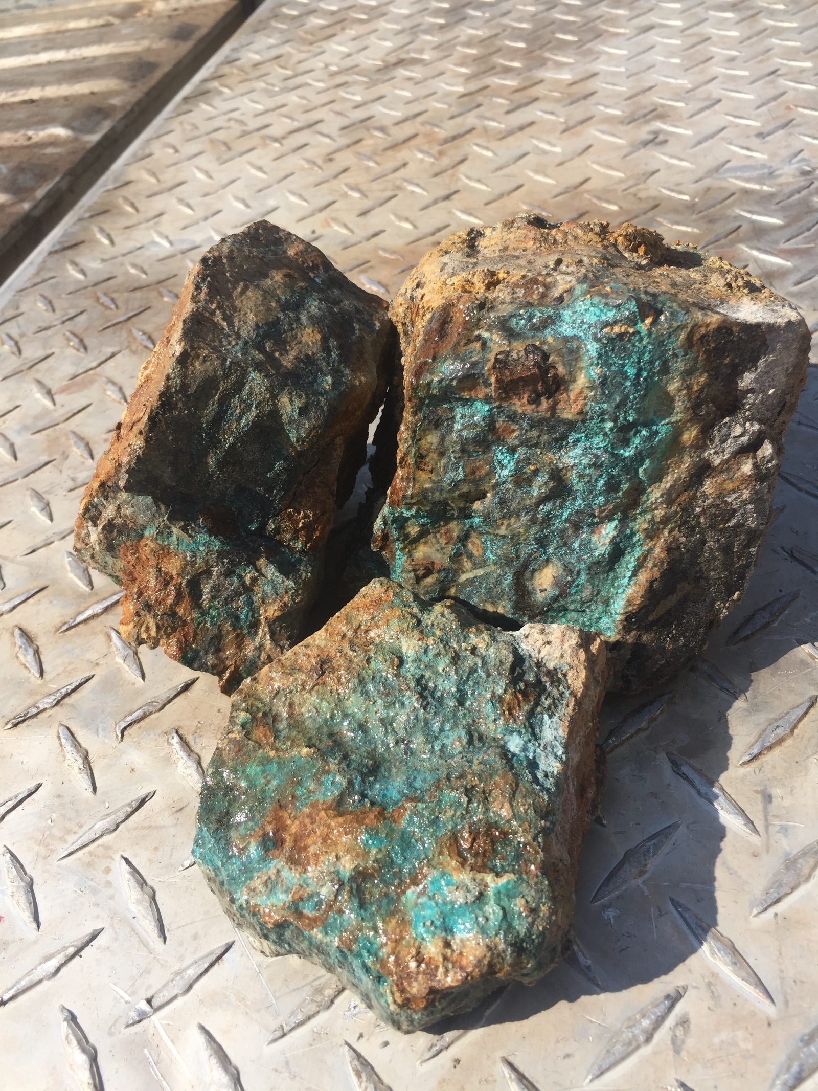
The Bayhorse mineralization consists mainly of acanthite, tetrahedrite/tennantite, and occurs in an 80 feet wide and 22 feet thick zone extending for a known 840 feet along an andesite and rhyolite contact. The Company has extended the thickness of the mineralized zones from 20 feet to approximately 70 feet. Minor copper, arsenic, and vanadium are associated with the silver. Azurite and malachite coatings are common in oxidized parts of mineralized ground on the walls of the excavated stopes. Additional minerals include enargite, dufrenoysite and cuprodesclosite. Gold values of up to 10 g/t Au have also been reported in the mineralization.
Mineralization at the Bayhorse Silver Mine occurs in a rhyolite host within veins, stockworks, replacements and pods dominated by sulfosalts tetrahedrite-tennantite, acanthite and other sulfosalts together with abundant sphalerite (Leitch 2013). Chalcopyrite, galena and minor pyrite are present.
The Bayhorse mineralization is present in two high grade zones: the Big Dog, where mineralization trends southwest, and the Goldilocks, which is 40 meters (130 ft) north of, and 25 meters (82 ft) higher in elevation, and trends northwest.
(The Company cautions that drill and mined and concentrate grades do not change the inferred resource classification of the Bayhorse.)
| Category | Short tons | Average grade (opt Ag) | Contained silver (oz) |
|---|---|---|---|
| Inferred | 292,300 | 21.65 | 6,328,400 |
The maiden resource comprises 292,300 short tons at an average grade of 21.65 troy ounces per ton (opt) silver (Ag) for total contained silver of 6,328,400 ounces. The mineralized material contains significant amounts of copper (Cu) and zinc (Zn). However, the historic data utilized in the mineral resource estimate did not allow for a reliable calculation of the grade of Cu and Zn.
There can be no assurance that additional work will result in the definition of the current resource being upgraded to a reserve.
The Bayhorse Silver Mine is a past producing mine. The Company has brought the mine back into an operating status. As disclosed in the National Instrument 43-101 Technical Report on the Bayhorse Silver Mine, there is a known mineralized zone (Herdrick 1981) at the Bayhorse Silver Mine reportedly approximately 840 feet in length, 85 feet in width, and 22 feet thick, estimated to contain 160,000 tons of silver bearing mineralization at a reported grade of 17-20 ounces per ton silver at a 7.5 ounce per ton cut off.
(The Company advises that a qualified person has not done sufficient work to verify the historical estimates nor classify the historical estimates as current mineral resources or mineral reserves and the Company is not treating the historical estimates as current mineral resources or mineral reserves. There can be no assurance that additional work will result in the definition of any current resource or reserve.)
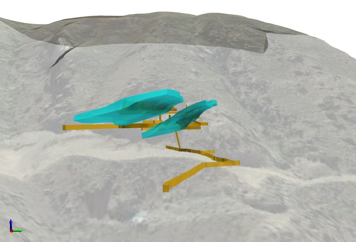
Underground model and resource envelopes
Inferred mineral resources are not mineral reserves. Mineral resources, which are not mineral reserves, do not have demonstrated economic viability. There has been insufficient exploration to allow for the classification of the inferred resources tabulated as an indicated or measured mineral resource, however, it is expected that the majority of the inferred mineral resources could be upgraded to indicated mineral resources with continued exploration.
The recent “low-mag” interpretations at both the Bayhorse Silver Mine, and in Idaho, have led to a re-analysis of our underground drilling program at the Mine.
We are currently drilling around the historically mined, Big Dog stope, to determine how the mineralization lies, and whether gold is present, as was historically reported (1984 Silver King Mines).
The current underground drill program is to further advance knowledge about our known silver deposit for recommencement of mining operations, as well as to understand to what degree the low resistivity zone, and low magnetic zone west of the existing underground workings are mineralized.
The low-resistivity/high-conductivity target shown below extends from immediately outside and underneath the Bayhorse Mine portal (elevation at 2,340 feet asl). The first drill intercept of the anomaly at line 1040 should be around 500 feet (151 m) below the mine portal with an indicated vertical extent at line 1050 to the indicated bottom of the anomaly of +/-1320 feet (400 m). The north-south strike extent is +/- 1650 feet (500 m) from north to south.
The drill program is to confirm the presence of a porphyry copper deposit, and if confirmed at the Bayhorse, there is a high probability it will also occur at the Pegasus anomaly, 5,000 feet (1.5 km) to the southwest.
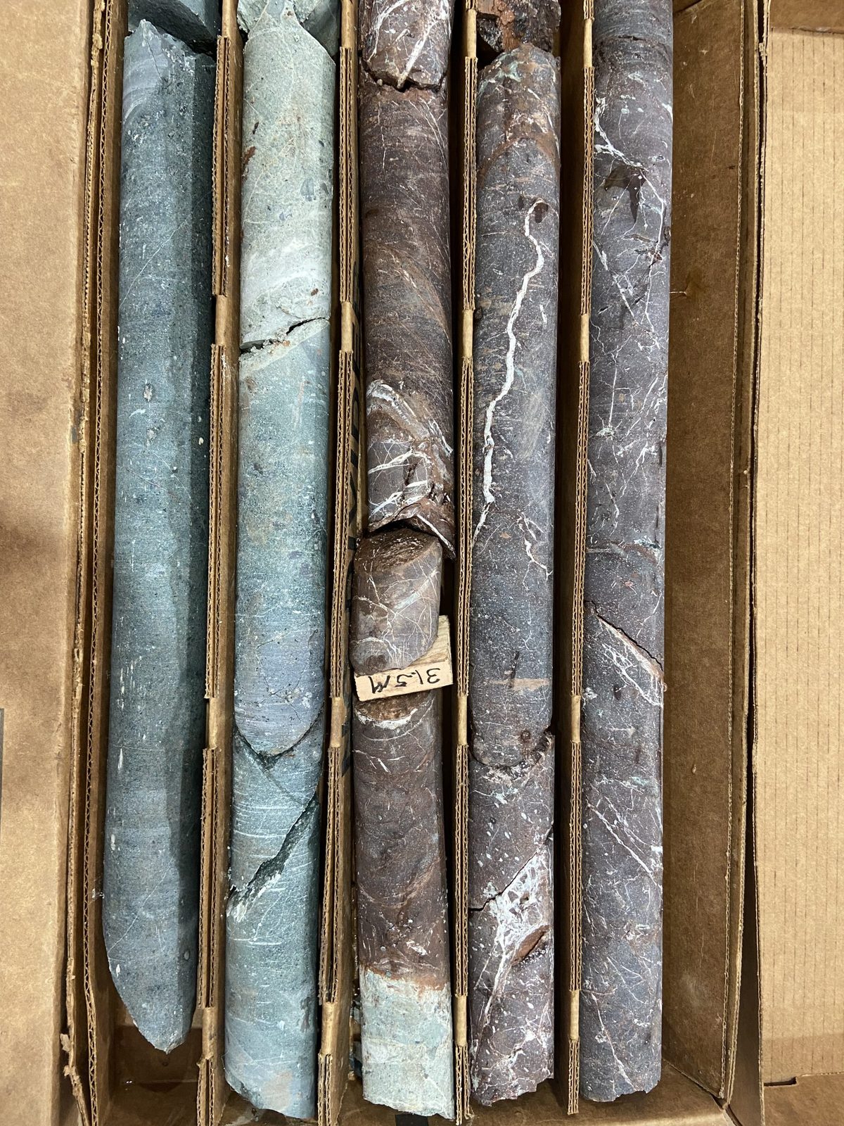
Drill core in core boxes
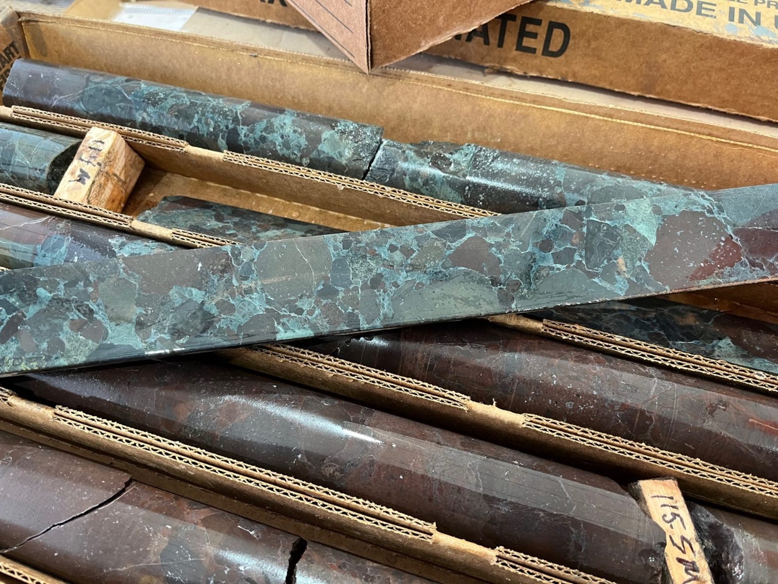
Drill core from the underground program
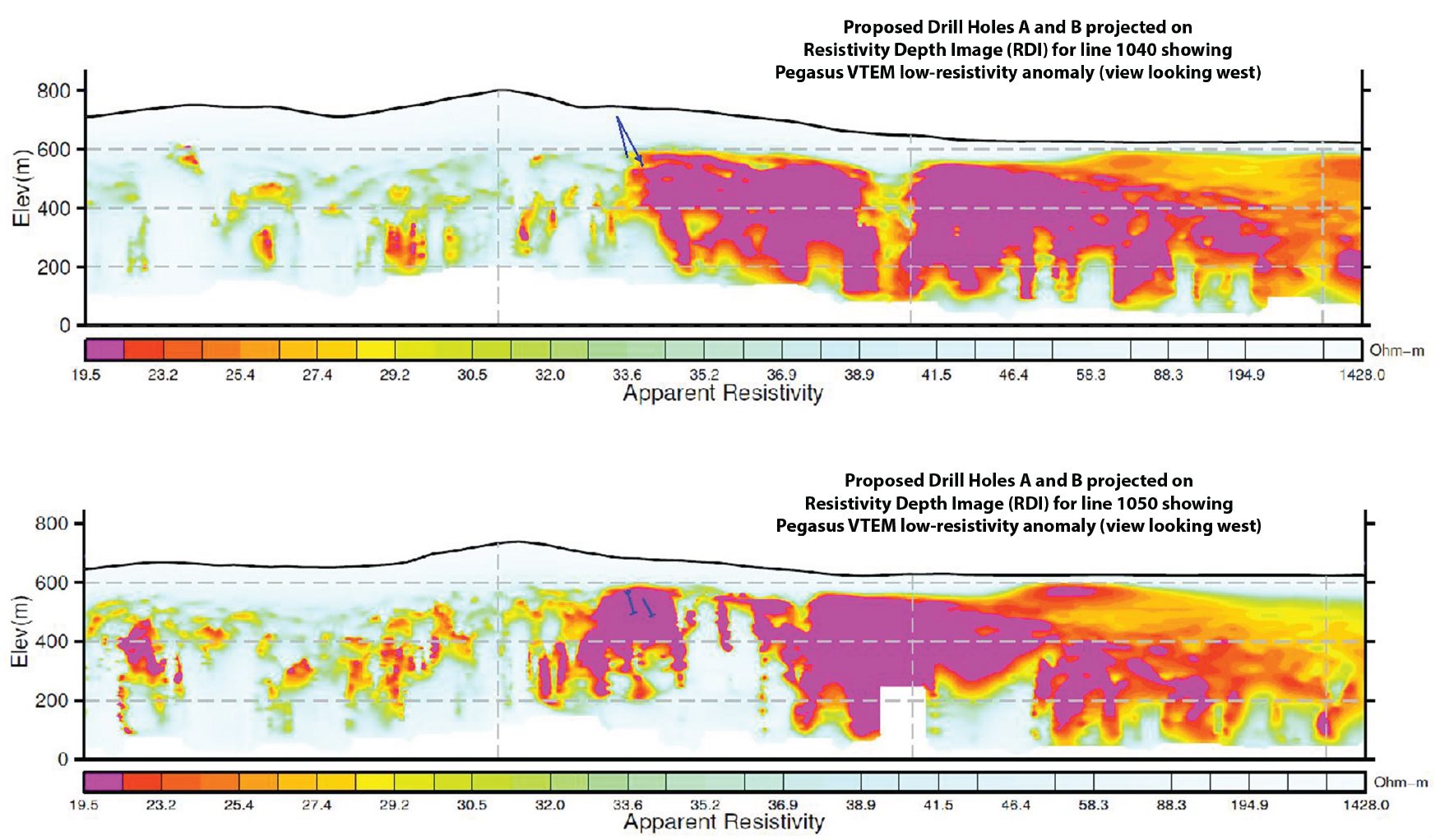
Low resistivity sections with drill traces, September 2024
Recent drilling directly above and to the north of the main haulageway, has identified a 3.5 meter (12 ft) intersection averaging 24.65 oz/t (766 g/t) silver that is 3 meters east of a historic 24.5 meter (80 ft) raise. This mineralization rises at a 45 to 50 degree angle to the north and is between 2.5 and 3 meters (6 to 8 ft) thick.
This intersection confirms the high grade mineralization reported in 1984 when the mine was shut down over low silver prices (<$5.00/oz). It appears to form a solid zone of minable, high grade mineralization (each square is 5 meters (16.5 ft)) that is open to the north, east, and west, and that will be immediate high grade mill feed.
Goldilocks Zone, Current Working Face Establishment, where recent drill intersection graded an average of 24 oz per ton (746 g/t) over 12 feet
This intersection is 55 feet up a historic raise that is being rehabilitated. Two new mine working faces are going to be established up this raise that will also be used to produce high grade mill feed to the Bayhorse Mill.
(The Company cautions that drill and mined and concentrate grades do not change the inferred resource classification of the Bayhorse.)
Bayhorse Silver is in the process of an Operating Permit application to resume mining at its Bayhorse Silver Mine, Baker County, Oregon, USA.
The Oregon Department of Geology and Mineral Industries (DOGAMI) guidelines for an Operations Permit Application under MLRR Division 35 Application Requirements (OAR 632-035-0025) require local and regional information be collected on Vegetation, Soil/Overburden, Climate/Air Quality/Precipitation (including modeling 100-year, 24-hour precipitation event), Fish/Aquatic Biology, Wildlife (terrestrial/avian), Surface Water, Groundwater, Area seismicity, Geology and Geographic hazards, Mineralogy and Chemistry and Noise, to provide a characterization of baseline conditions. These conditions include the 100 year 24 hour precipitation event.
The Bayhorse Silver Mine is a past producing mine. The Company is undertaking the permitting process with DOGAMI to obtain a full operating permit H2 2027 and production early 2028.
The Company has all the required equipment, currently placed on care and maintenance, to commence production at the Bayhorse Silver Mine.
Bayhorse Silver is using Ore-Sorting, a totally dry process, to increase grades by reducing the volume of rock in the process stream, and as a bonus, minimize potential pollution commonly associated with mining. It offers the potential to substantially lower processing costs, substantially increase the grade of mineralization shipped, and the prices received.
We take the Ore-Sorted pre-concentrate from the mine site to our Mill in Payette, Idaho, where it is ground to between 80 and 120 microns (really fine beach sand). After grinding, we mix it with a very small amount of reagents (100 grams per ton) and pass it through two stages of flotation: roughing and cleaning.
We then thicken the concentrate and pump it to a pressure filter, or vacuum filter, to remove the water and dry the concentrate (Material Safety Data Sheet, MSDS).
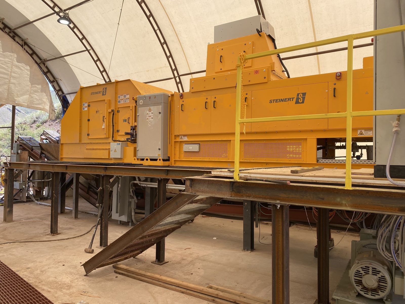
Steinert XRT ore sorter
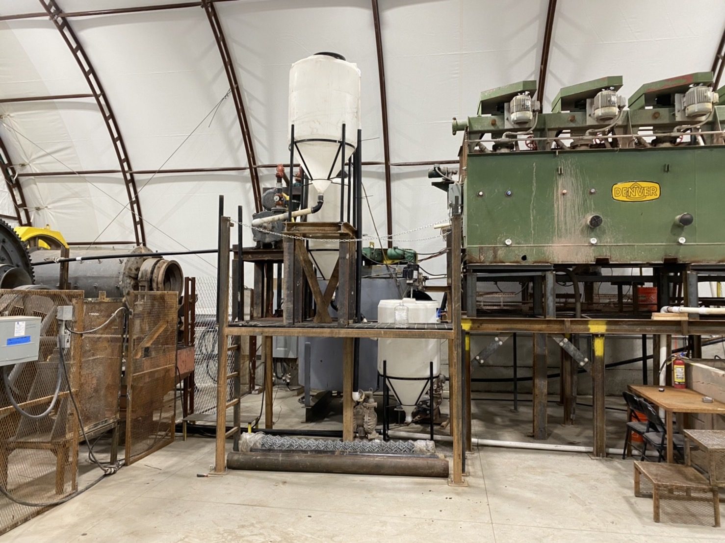
Flotation cells at the mill in Payette, Idaho
The historic letters and maps shown, and maps and plans of what was mined in the 1984 mining program, sampling of the upper levels, and drill intersections in areas that were unmined, are of a historic nature and are subject to confirmation by the Company.
Reach the Bayhorse Silver team directly.